You’ve got to check this out; they’ve improved sense the last time I’ve looked. DeKalb isn’t covered with as much detail as this, but Chicago suburbs are. What I’m talking about here is Google Maps. This is a new thing from Google; they have a far superior map system than Mapquest or Mapblast. If you want directions to Florida from Chicago, those maps will tell you to go to Alaska then to Florida. Anyway Google Maps also has a little link for a Satellite view, and that’s what this picture is.
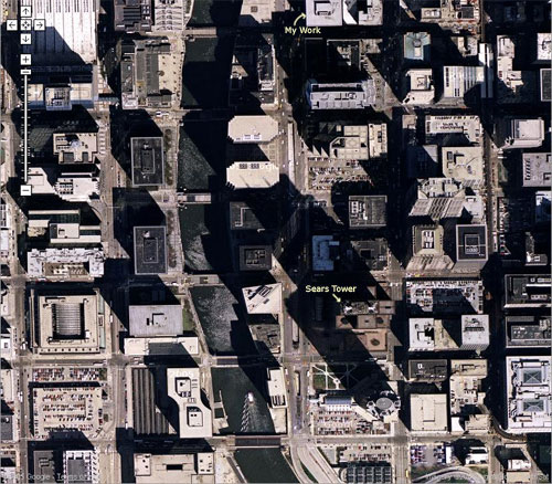
It’s amazing the detail they get from satellite views, click on the picture and get a close view, it’s a detail of Wacker, just east of the River downtown Chicago. You can even see the cars driving on the road, a boat in the water, incredible detail. Anyway I should be getting paid for this (talk to Google for me, will you?) So try your address, see what your neighbors are hiding in their backyard behind their fence.
Seeing as not all the satellite images are current, the last statement is sort of irrelevant.
Yea I suppose, I should have said: Try your address, see what your neighbors were hiding in their backyard.